


UtiliPad app for iPhone and iPad
Developer: Tri-Global Technologies
First release : 11 Apr 2016
App size: 81.17 Mb
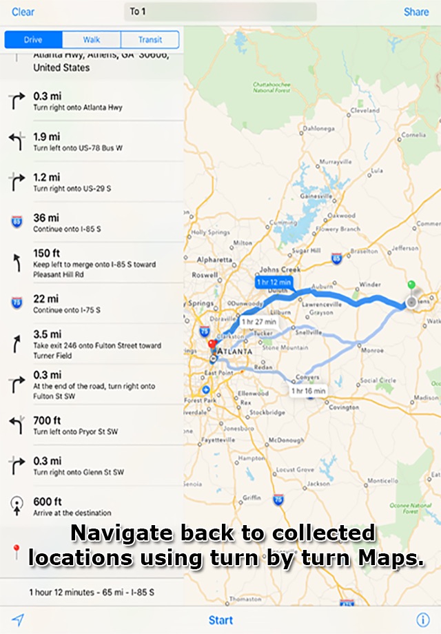
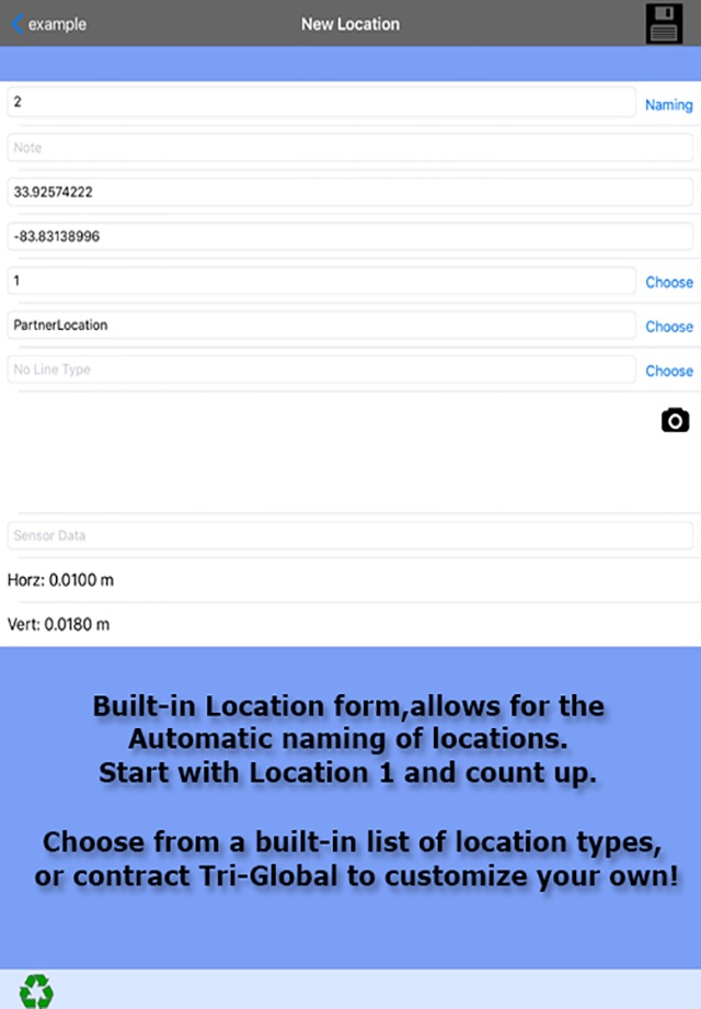
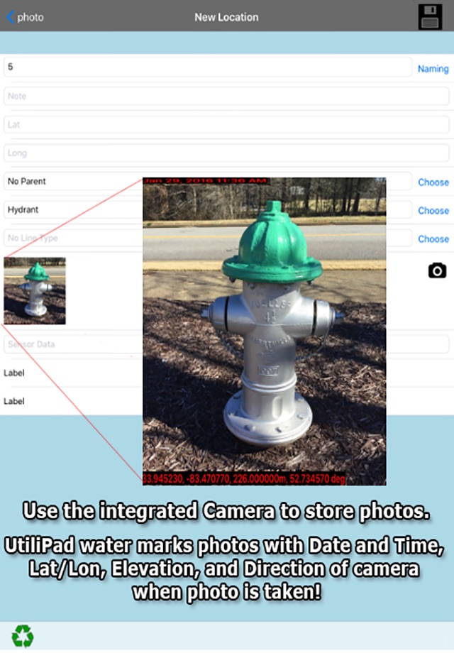
UtiliPad allows field technicians the ability to capture highly accurate GNSS data measurements using supported third party hardware (sold separately) directly on his/her iPhone or iPad device. Like Tri-Global Technologies’ other software innovations, all information collected is centric to utility line operations. UtiliPad users have the ability to simply switch between utility line types, collect accurate geographic locational data, and record simple attribute information including, but not limited to, type of feature, photograph, notes, and relational spatial data references. Upon completion of field collection activities, user can then save work as a PDF map datasheet and transfer into their iTunes library. This PDF map datasheet can be used as a simple As-Built generation tool for any type of basic utility design or documentation.
Please note: Continued use of GPS running in the background can dramatically decrease battery life.